
Gardner Previous Residents by Era
A Gardner address can cross several record eras. Begin with the current parcel, but choose the next source by date. AIMS supplies the present situs, parcel number, subdivision, plat, and legal description. Deeds then document recorded interests. The Polk volumes and census schedules add people who may have lived there, while newspapers, obituary cards, permits, and maps explain changes. No one source proves the full line of previous residents.
| Source | Verified period | Keeper | Use in the address trail |
|---|---|---|---|
| AIMS parcel card | Current, with historic tabs where available | Johnson County AIMS | Situs, parcel, legal description, plat, maps, and dated property fields |
| Register deed index | Legacy index described as 1920-present | Johnson County Register of Deeds | Grantors, grantees, instruments, dates, and document references |
| County deed series | 1857-1995 finding-aid range | KSHS and County Archives | Earlier ownership leads when the online chain ends |
| Polk directory including Gardner | 1961-1984 | Johnson County Library | Edition-date household and address clues |
| Census schedules | Territorial 1855-1859; state 1865-1925; federal public through 1950 | KSHS, NARA, and library databases | Household snapshots tied to an enumeration date |
| Obituary cards | 1977-2000 | Central Resource Library | Citations that can connect a former household to family and death notices |
| Sanborn reference | November 1925 | Kansas Historical Society | Building form, use, and nearby physical features |
For recent ownership, start with AIMS and the Register. For a mid-century household, ask for the in-library Polk edition and pair it with a census year. An older tract needs legal-description work in the archives. Gardner permits have no verified continuous online run, and the cemetery has early record loss, so neither should be treated as complete.
Fix the Gardner Address First
The Johnson County AIMS map is the firm starting point for previous residents research. Search the street address, click the matching polygon, and retain the Tax Property ID, situs, Kansas Uniform Parcel Number, subdivision, plat book and page, abbreviated legal description, and map context. Owner mailing and situs fields must stay separate. The first is a tax-contact address; the second is the parcel location. Neither is a roster of everyone in the home.
A property identify window may link to Information, Photos, Documents, Plat, Permits, Utilities, and Location tabs. Treat each item as dated evidence. A photo may show a structure, and a permit may date work, but those clues do not prove who occupied the house. The current card also helps detect a split, replat, common tract, or road parcel before the deed search starts.
- Situs address
- The mapped physical address of the parcel.
- Legal description
- Land wording based on a lot, block, plat, or survey that can survive a street-number change.
- Chain of title
- The sequence of recorded transfers affecting the same land.
Note: AIMS map linework is a research aid, not a certified survey or a legal title opinion.
Walk Gardner Deeds Backward
The Johnson County Register of Deeds connects the parcel to recorded owners. The legacy public index is described as reaching from 1920 to the present, while the current Document Library notice separates scanned documents from 1920-1987 and plats from 1866-present. Its move to a new Enterprise Records Management system in fall 2026 may change remote access. Save the query date and image status with each result.
- Copy the current AIMS owner, parcel ID, plat, and legal description.
- Find that owner as the grantee, or buyer, on the purchase deed.
- Record the grantor, instrument type, recording date, document number, book/page, legal description, and image status.
- Search that grantor as an earlier grantee. Repeat while the land description remains consistent.
- At the online cutoff, carry the last parties and legal description to the public terminal, County Archives, and KSHS finding aids.
- Grantor
- The party transferring a recorded interest.
- Grantee
- The party receiving that recorded interest.
- Instrument
- The filed deed, release, assignment, plat, lien, or other record shown in the index.
Trusts, estates, business names, middle initials, and survivorship language can break a simple name chain. Follow the land description, not just the spelling. The office terminal is free. Requests may also be made in person or by email, and the Register offers search appointments. Copies are listed at $0.25 per page and certification at $13.
The Register of Deeds Document Library shows the current transition and coverage notice.
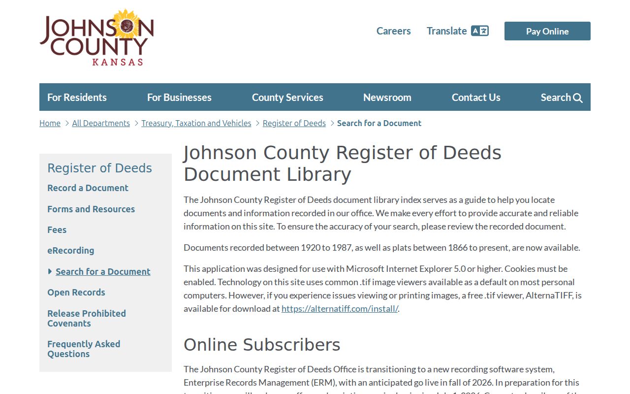
The captured notice is useful because a searcher can distinguish the legacy index description, document-image span, plat coverage, and changing account route.
Gardner Records Before 1920
The 1920 online boundary is a handoff, not the start of Gardner land history. The county was established in 1855 and organized in 1857. KSHS finding aids place Johnson County deeds in an 1857-1995 range, and County Archives holds older tax, court, probate, naturalization, and Register series. A tract may predate both its subdivision and street number.
Bring the last online grantor and grantee, legal description, plat, book/page, and all name variants to the Johnson County Archives Research Room. Appointments are apt for the Olathe room. Copies cost $0.25 per page, and staff research is limited to 30 minutes before the listed hourly charge begins. Staff do not conduct full genealogy or census searches, so a narrow parcel-and-date question works best.
The KSHS Johnson County collection adds deeds, probate, court journals, title abstracts, and local reminiscences. This archive chain explains the Profile 2 myth worth remembering: online records do not mark the beginning of the record itself.
Gardner's 1925 Map Snapshot
A deed says who held an interest. A fire-insurance map can show what stood near the address. The Kansas Historical Society Sanborn listing identifies Gardner, November 1925, as MS-1332. A sheet may show a building footprint, number of stories, construction material, use, and nearby streets or rail features. It can help test whether the modern parcel occupied the same physical setting.
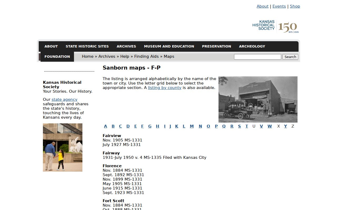
The captured KSHS reference anchors the date and collection. Full scan access must still be confirmed through KSHS, the Library of Congress, or the library before claiming that a page is viewable online.
Compare roads, the BNSF corridor, US-56 or Old Highway 56, town lots, and the deed description. Those physical anchors can be more stable than a house number. A Sanborn match dates a structure and setting, not its occupants.
When Gardner Numbers Do Not Match
No official citywide street-renumbering or renaming year was verified for Gardner. That gap matters. An old deed may use township and range, a rural route, an old highway name, or a subdivision description where a later source uses a numbered street. Search both name forms and keep the plat or legal description as the link.
AIMS historic right-of-way material, covering roughly 1850-1949, can help explain old roads. City ordinances, annexation maps, plats, and dated newspapers may show when a tract entered Gardner or gained a new address. Do not call a missing directory hit an empty house. The publisher may have omitted the edge of town, used a different number, or skipped that edition.
Continuity rule. Carry the lot, block, plat, and book/page through every address change before deciding two records concern different land.
Gardner Past Residents Beyond Deeds
Owners are only one part of a house history. The Johnson County Library catalog confirms an R.L. Polk directory including Gardner for 1961-1984. It is marked for in-library use. Exact reverse or criss-cross years were not verified, so ask the Genealogy Desk for an address section in each target edition. The collections themselves are detailed on the Gardner city directory page.
For each edition, copy the year, page, street spelling, household notation, spouse or widow marks, owner or non-owner sign, and abbreviation key. Then pair the result with a public census snapshot.
- Start with a known Gardner street address and one directory edition.
- Check the next and prior editions by both name and address.
- Compare a nearby federal or Kansas census year, while noting its exact enumeration date.
- Use newspapers, probate, and obituary citations to explain a move, death, estate transfer, or name change.
The library's obituary card catalog covers 1977-2000 and usually gives a citation rather than an image. Gardner Gazette is indicated for 1899-1942, with several shorter local titles also identified. Search the address, legal notice, probate notice, spouse, and street variant. A probate address may belong to an heir, executor, or lawyer, so verify it against the deed.
Lawful use. Gardner previous residents research fits house and family history. Never use a past address trail to track, harass, or intimidate a living person.
Grade Each Gardner Resident Clue
A reliable conclusion states exactly what each source proves. A deed records an interest in land. It does not prove that the grantee slept there. A directory places a printed name at an address in one edition, subject to the publisher's methods. A census captures a household on one enumeration date. A probate file or obituary records a family or estate tie, and AIMS supplies current property context.
Save source title, keeper, query date, edition or record date, page or instrument number, and access status. Mark an inference as an inference. That record log keeps two same-name people apart and lets another researcher repeat the work when a portal changes.
| Strong ownership evidence | Recorded deed tied to the same legal description |
|---|---|
| Strong household snapshot | Named census or dated directory entry tied to the address |
| Useful support | Obituary, newspaper notice, permit, map, or cemetery citation |
| Not enough alone | Tax mailing address, modern map label, or an unverified same-name result |
The result is a dated, source-led account of who lived here before, with gaps shown rather than guessed away.